// Product Detaıls
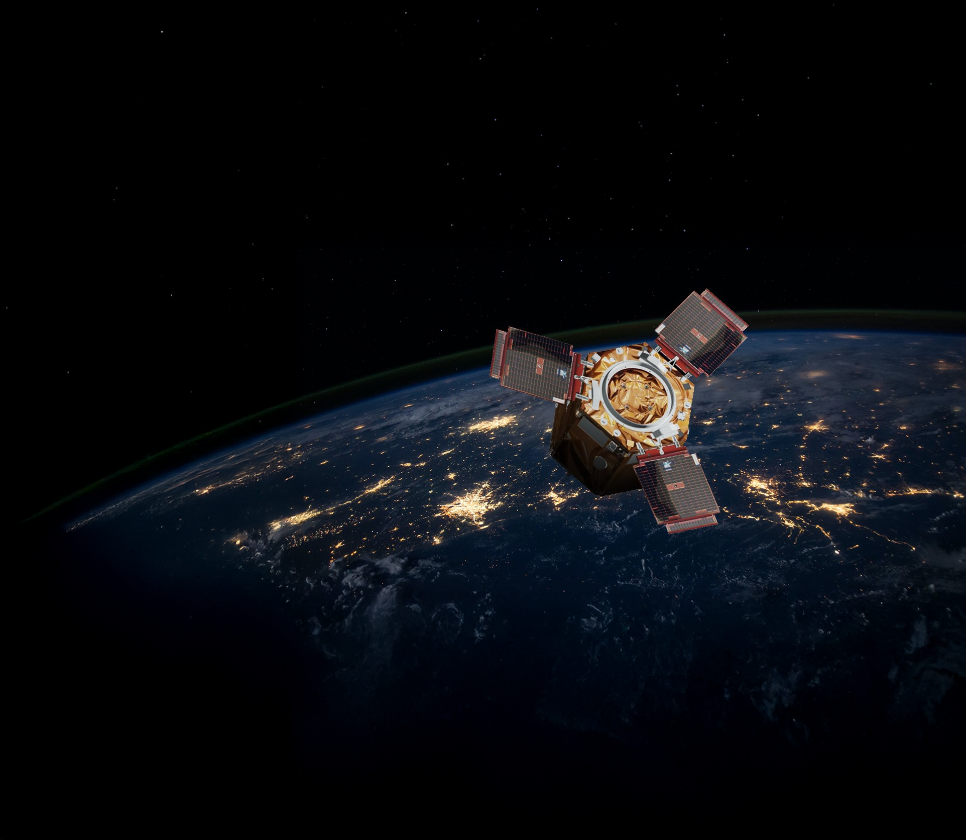
Gökbörü is an innovative platform designed to perform high-accuracy object detection and tracking over wide geographic areas. It has been specifically engineered by Üstünova to play a critical role in military intelligence particularly for naval systems.
Core Capabılıtıes:
The Image Intelligence Program delivers a high-accuracy and high-speed analytical capability geographic zones. It empowers decision-makers with critical intelligence insights. With its field-proven application, satellite imagery captured from naval platforms can be analyzed to monitor ship traffic, coastal activities, and strategic targets.
Advancements in technology have significantly expanded the scope of modern warfare. In this context, determining the exact coordinates of enemy military units, radio and radar stations, and ammunition depots, as well as tracking the movements of military vehicles, aircraft, ships, and even submarines, has become increasingly crucial.
The demand for satellite imagery to meet these intelligence needs is growing rapidly. However, the rapid and accurate analysis of data obtained from satellite imaging systems is essential.
Currently, this data is analyzed manually by human analysts. The reduction in expert personnel, the time-consuming nature of manually analyzing a large volume of imagery, and the potential for human error could lead to irreversible mistakes by decision-makers.
Preligens, one of the world's leading firms using AI-powered operating systems to analyze satellite imagery, counts NATO among its clients, particularly the NATO Allied Command Transformation and the NATO Intelligence Fusion Centre, which are the primary users of the company's data.

An image captured by a sensor is not intelligence on its own. Only after a trained Imagery Analyst (IA) performs a specific analysis using certain tools and techniques does "image intelligence" emerge.
The Gökbörü platform is designed to meet all the needs of an imagery analyst. It offers high data processing capacity, archival capabilities, and reporting in requested formats.
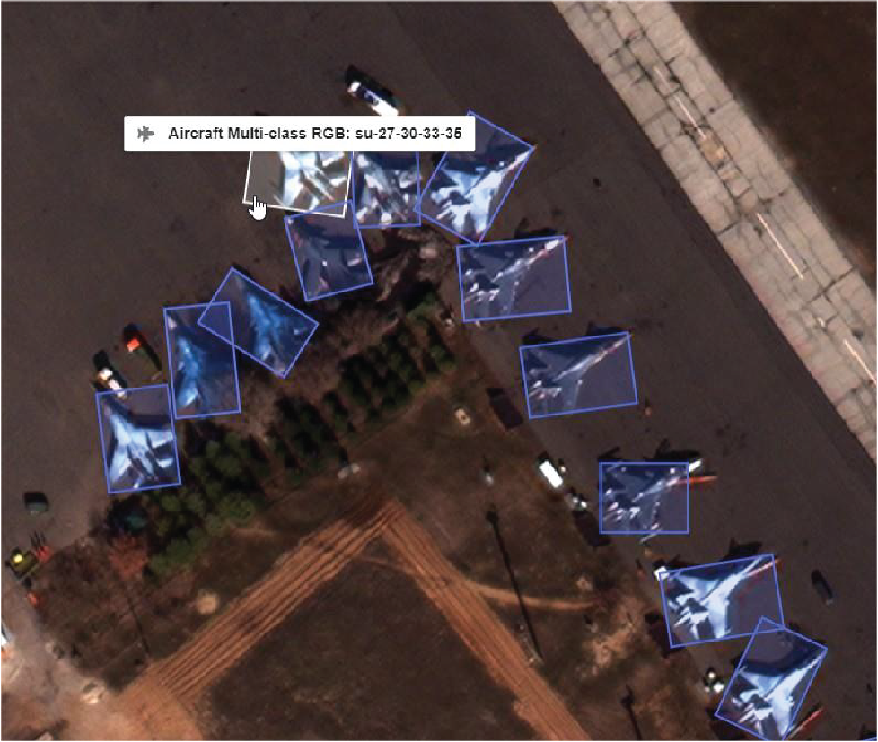
It can analyze satellite images in under a minute using its AI-supported framework.
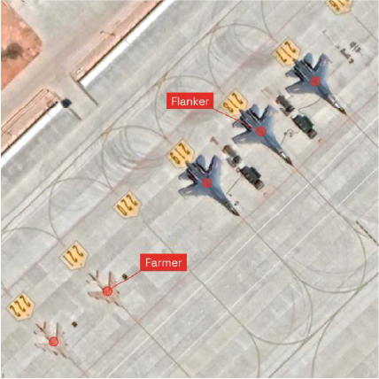
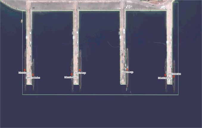
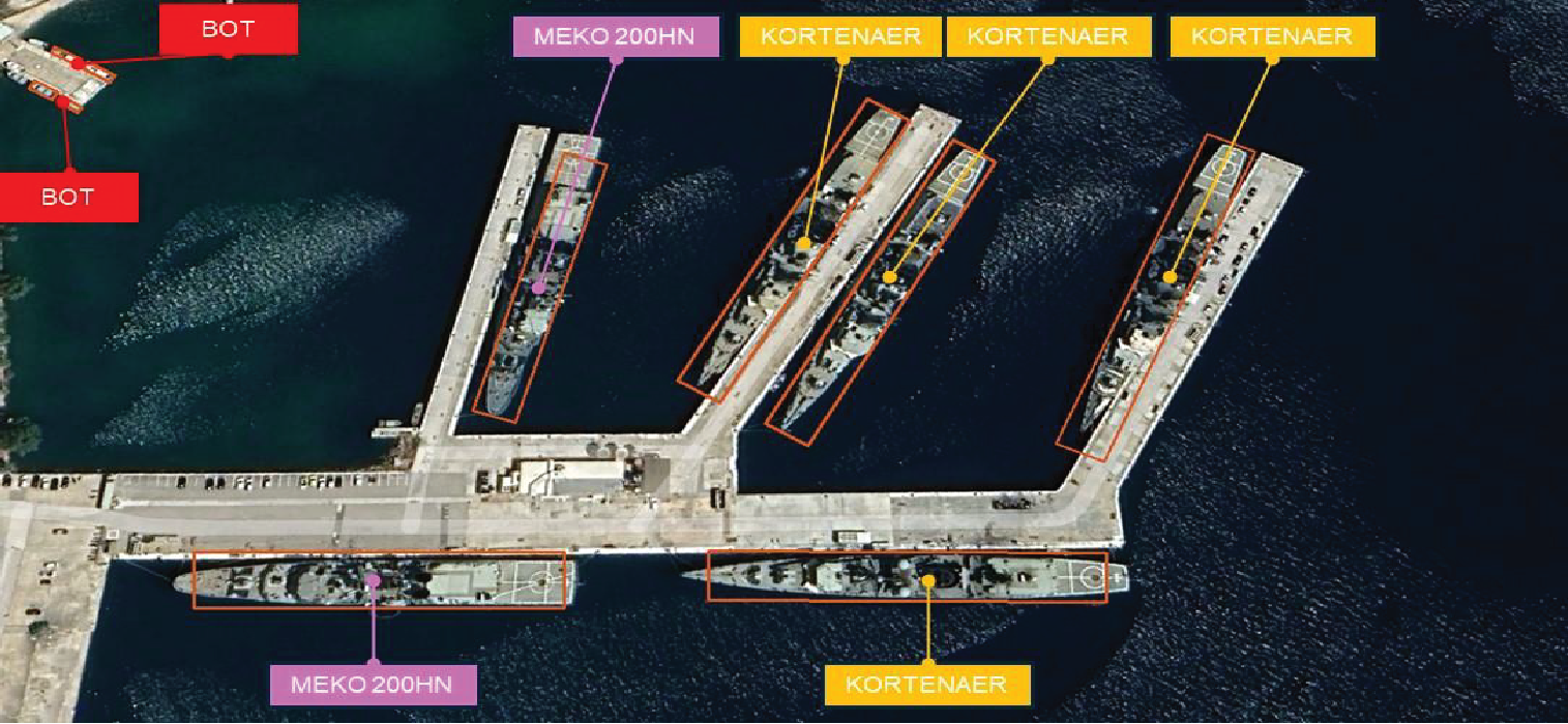
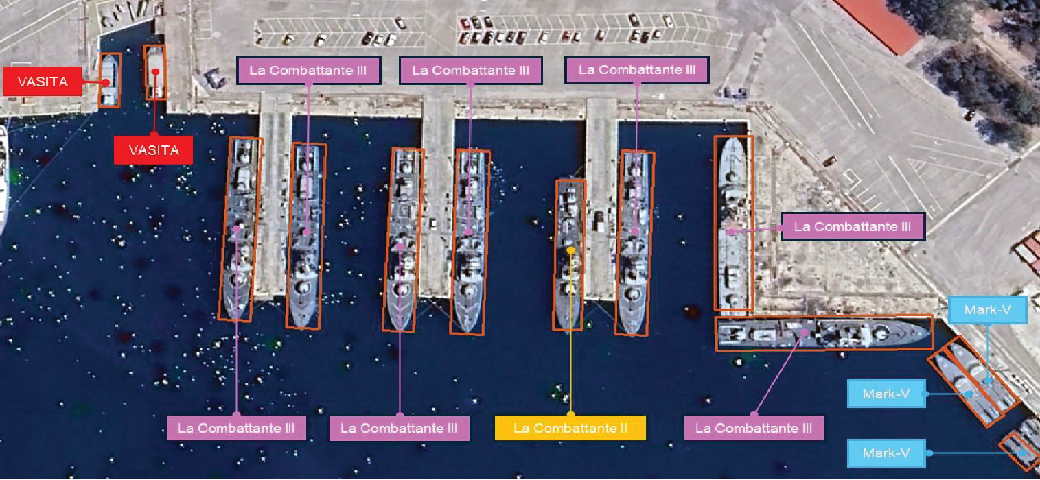
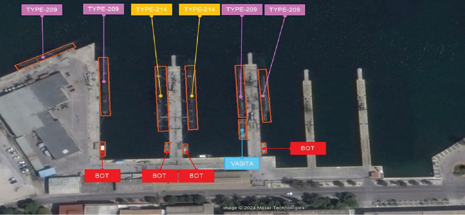
The system can detect and classify objects such as: trucks, buses, ships (e.g., frigates, fast attack crafts, submarines), and aircraft (e.g., F-16, Mirage, C-130).
With operational experience, it gains advanced target recognition capabilities. For instance, instead of generically classifying a ship as a frigate, it can identify the exact class (e.g., MEKO Class, Admiral Grigorovich Class, FREMM Class).
At Üstünova Engineering and R&D, we have implemented various projects, internally and through external partnerships, aimed at enhancing our competencies in artificial intelligence and image processing.
We continue to follow developments in this field closely and integrate our capabilities into other areas of work with determination.
Our primary objective for future activities is to transition the competencies we've developed in civilian applications into the defense intelligence domain, integrating them with cutting-edge technologies to facilitate the production of high-value-added intelligence.
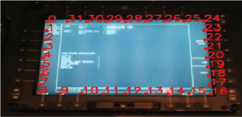
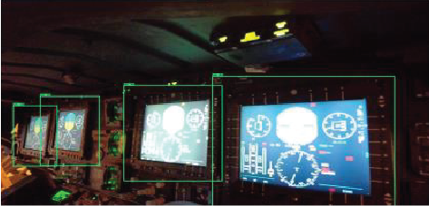
This system assists helicopter technicians in the event of a fault. It first detects the display screen, analyzes it, and then automatically retrieves relevant maintenance manual information stored in memory to assist the user via an intuitive interface.
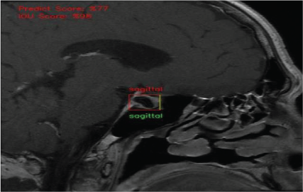
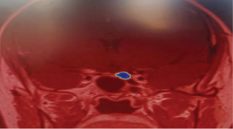
This application reads DICOM files from MRI devices and converts them into images. Using AI-based object detection, it identifies the pituitary gland's location. A second AI algorithm (segmentation-based) analyzes the marked area. If a disease is present, it highlights the affected region for radiologists.
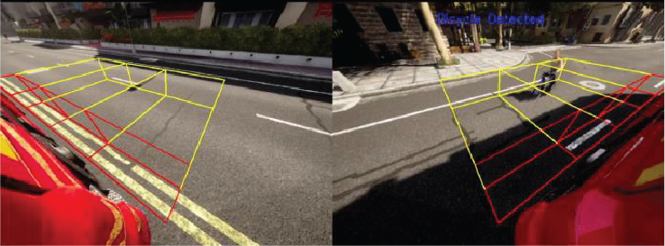
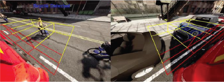
This in-house developed simulation project is designed for large commercial vehicles. It uses cameras to detect whether there are living or non-living objects within blind spots and warns the driver accordingly. The simulation defines the three-dimensional warning zones as per United Nations Economic Commission for Europe requirements, mandatory as of 2024. These volumes are projected into 2D areas that are monitored in real-time using AI to detect obstacles.
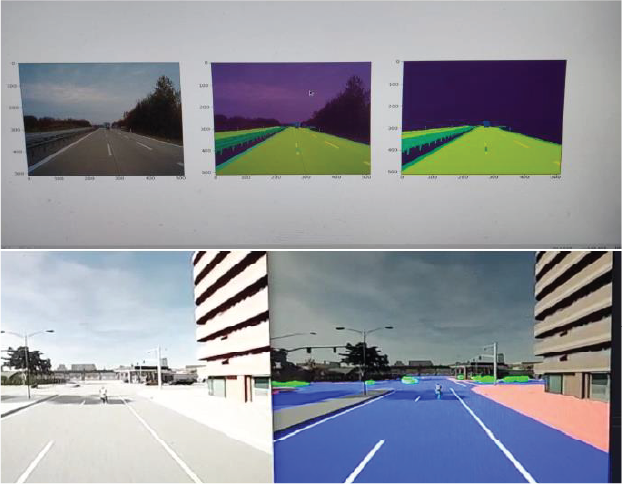
This project aims to develop an autonomous vehicle capable of charging itself and moving to the user's vehicle without infrastructure dependency. The system utilizes both 2D and 3D sensors in conjunction with image processing and AI techniques (object detection and segmentation).
Road surfaces, lane lines, sidewalks, and vehicles are segmented individually. This allows the vehicle to analyze its route and proactively avoid potential collisions.
Ankara University Teknokent, Bahçelievler Mah.
319 Cad. No: 35, C1/5 06830, Gölbaşı, Ankara
+90 (312) 485 66 99